Roadtrip
I’ve been meaning to get away for a solo roadtrip for a while. I’ve had a couple of short trips over the last couple of years, but they kept getting cut short — three- or four-day trips that were reduced to a single night away.
I made time at the end of last week for a solo trip, though, and had a great adventure. (Unfortunately, as you’ll see, my camera wasn’t the best. Even with a good camera, capturing the scale of the national parks I visited is tough. When you’re taking photos with a potato, good luck.)
I love being around people, and — especially during quarantine — miss being with friends more. But there’s also something great about getting away by yourself. I wish I could say that I had some sort of deep contemplative epiphany, but it’d be unfair to set that up as an expectation of a trip like this. Mostly, I just wanted to see some national parks that I haven’t seen since I was a teenager. (We’re planning another cross-country drive this winter as a family, so this was also a bit of a scouting run.)
I got accustomed to long days of driving this summer, during our inagural cross-country trip (which I should write up notes on at some point; it was great); this trip only reaffirmed that, yes, I like driving, and no, long distances aren’t a problem. The four days of this trip saw drive times of 12 hours, 4 hours, 17 hours, and 8 hours. That third day was a doozy.
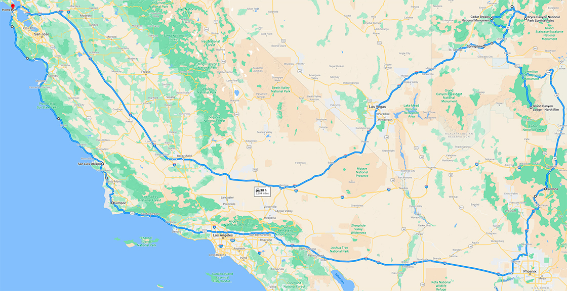
Day One: SF to Zion
I’d intended to leave at the crack of dawn, but had a few projects to wrap up before I could leave. I finished them up around 10, and was able to pack up and get out the door just after lunch. Driving on Route 5 was easy, but — hoo, buddy — was it boring. The entire span from Tracy through Bakersfield is a whole lot of nothing. And then you get to the desert. It was getting dark when I crossed into Nevada, and fully dark by the time I passed through Las Vegas. Upside to that, though: have you really seen Las Vegas if you haven’t seen it at night?
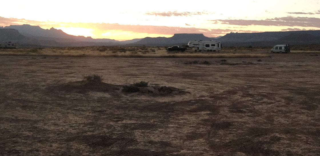
I continued on, and made my way to some Bureau of Land Management land outside of La Verkin, UT, where I camped for the night.
Cool thing a lot of people don’t know: Almost all Bureau of Land Management land and National Forest land is available for you to camp on — no cost, no reservation needed. (Check out the “Dispersed Camping” section of this BLM page on camping on public lands for more.) If you go the route of dispersed camping, two good resources: the website freecampsites.net and the iOS app Outly.
Although I’d normally take a tent and set it up to sleep in, I tried something new this time. I brought a trifold foam mattress and a comforter, and just set them up in the back of my car (back seat down) and slept there. It actually worked really well, and meant that — in the morning — I didn’t have to pack anything up. Just fold up the foam mattress, flip the back seat back up, and get going. (Side benefit: the ground around here was extremely dusty — I mean … it is a desert — so a tent would have been covered in red dust. This was a lot cleaner.)
I’d definitely try this approach again, though I think a thinner mattress would be a bit easier to work with. Although the mattress I had was really comfortable, it took up a lot of space in the back of the car, and when you’re working with the trunk and back seat of a Prius, the bulk of a mattress like that can make things difficult.
The BLM campsite had a few more people than I was expecting — mostly RVs or fifth-wheel trailers — but I was able to find a spot pretty easily. And, again, since I was in my car, I was really just looking for something level and not too close to other people.
Day Two: Zion, Cedar Breaks, and Bryce Canyon
Upon waking up, I could see that, yes, there was some pretty great geology surrounding me. It was pretty nice to go from “it’s getting dark and you’re in the Mojave Desert” to “it’s dawn and you’re in the middle of some giant mesas and buttes.”
I drove to Springdale, UT to get breakfast and start my trip in to Zion. A ham and cheese omelette at MeMe’s cafe. Parking at the long-term parking in Springdale ($12 for the day). Biking in to the Zion walking/biking entrance gate.
Our “America the Beautiful — National Parks and Federal Recreational Lands Pass“ had expired, so I got a new one. $80 to get in to any national park or monument is such a deal. And I think — kind of like a gym membership — once you have it, you’re more inclined to just go. I’m a fan of anything that reduces the friction that stands between you and adventure.
Once in, I biked the 7 miles along the canyon floor to get to the Temple of Sinawava. Side note: The rock formations at Zion have some pretty amazing names — The Court of the Patriarchs, The Spearhead, The Great White Throne, Mountain of Mystery, The Sentinel. The biking in was pretty easy. I wish I could share photos with you of the bike in, but my camera just couldn’t capture the scale of the canyon or the formations at Zion.
Now at the Temple of Sinawava, I locked up my bike and “hiked” along the Riverside Walk, up the side of the canyon along the Virgin River. (It’s really a paved path.) After a mile or so I got to the trailhead for the Zion Narrows, which is one of my favorite hikes in the world. BUT! There’s currently an algae bloom in the Virgin River, where a cyanobacteria called Tychonema is releasing a neurotoxin in the water. So I didn’t do the Narrows hike. Plenty of other people were, though! And, odds are good that they were totally fine. But I was solo, didn’t have quite the right gear for a water-up-to-your-thighs hike, and didn’t want to run the risk of neurotoxin exposure. (Apparently, symptoms include “skin rash, salivation, drowsiness, tingling, burning, numbness, pain, incoherent speech, muscle contractions or twitching, vomiting, and diarrhea.” Goiks!) Hopefully the algae blooms and neurotoxins will have cleared up when I bring the family.
Anyway, I walked the mile back to my bike, then biked back to Springdale. Mostly downhill on the trip out of the canyon, so the bike ride back was easier and faster. Downhill return trips are always nice.
Back in Springdale I grabbed a slice of Bumbleberry Pie and ice cream, then headed to the car.
From Springdale, the drive up to Cedar Breaks was pretty easy. Highlight was the climb out of Zion Canyon, where several switchbacks gave some amazing views of different peaks in the park. After about two hours I made my way to a few overlooks at Cedar Breaks.
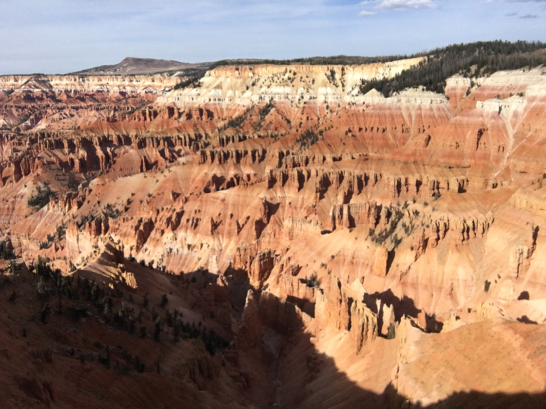
I’d never heard of Cedar Breaks before a few weeks ago, when I saw a blurb in the AAA magazine about it, as a less-busy version of Bryce / the Grand Canyon. I’m glad I went, but would only recommend going if you’re trying to see something different, or you want to go somewhere with fewer people than the other parks. If you do a similar trip but have to cut one, it’d be the one I’d suggest dropping. (I’m happy to hear from any Cedar Breaks apologists on why I missed the coolest part of it. If that’s you, please let me know.)
I then proceded on to Bryce Canyon, which was probably my favorite of the parks this trip.
Oh — quick aside. When driving in to Bryce from the west, you go through Red Canyon, which is a relatively short section of the highway where you feel like you’re in the middle of a Road Runner cartoon. The rocks are, as you’d expect, a bright reddish-orange, and have some pretty great shapes. No photos, unfortunately, as I figured I’d get some photos on my way out (and then it was dark when I departed in the morning). (Lesson from that: don’t assume you’ll be revisiting a cool spot later and put off grabbing photos now. If it’s neat, grab a photo.) Anyway, Red Canyon is absolutely worth swinging through, and if I’d planned my trip a bit better, I might have added some mountain biking on the trails here.
Anyway, through Red Canyon and on to Bryce. Will let the photos speak for themselves. No filters on these, by the way, though I can’t say why the color looks so different from shot to shot.
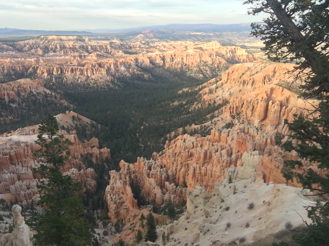
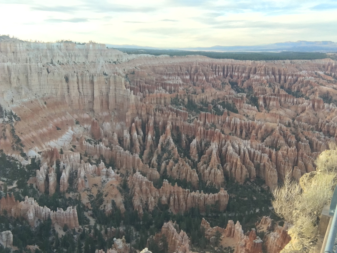
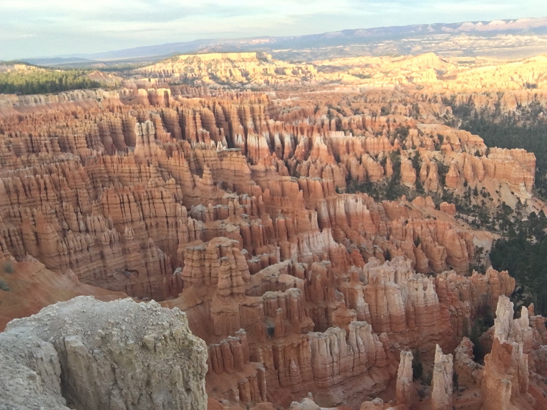
Fun word — those spires are called “hoodoos”.
I know the image of Bryce might look a lot like Cedar Breaks, but know that the scale of the two is very different, and the view you get at Bryce is much better.
I’m hoping to hike on into the canyon next time I go to Bryce. Hitting the view points is lovely, but I bet the views inside the canyon are ridiculous. So: biking at Red Canyon, hiking at Bryce.
The sun was setting, so I headed off to some more National Forest land for another night of car camping. I haven’t seen a more star-filled night sky since I camped across the country back in high school. It was pretty incredible.
Day Three: The Grand Canyon and an Epic Day of Driving
I woke up on the early side and figured I’d see what I could fit in to the day. So. Up and at ’em.
I first made my way to Kanab, Utah, which was apparently used as a backdrop for a number of western films back in the day. A breakfast burrito and latte from a foodtruck run by a nice Mormon lady, and then to the North Rim of the Grand Canyon.
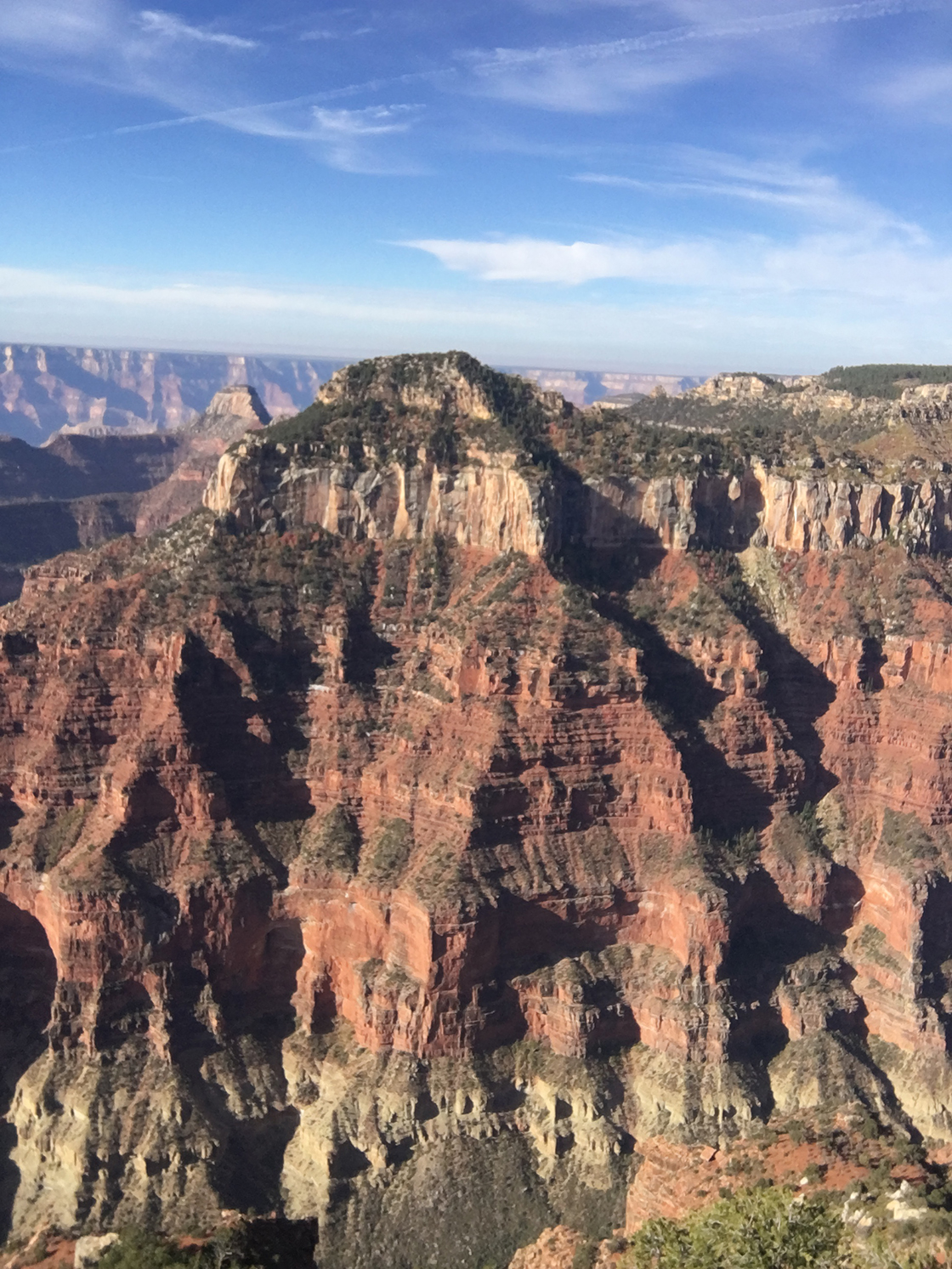
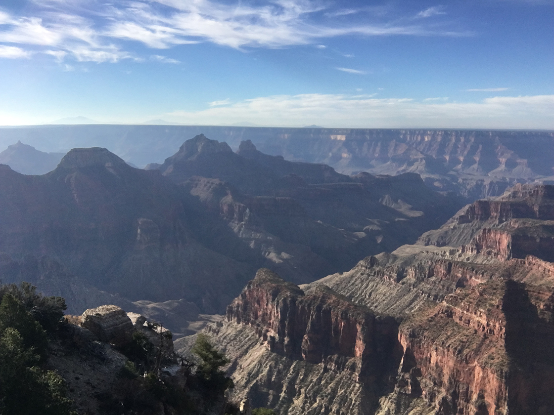
I was a little unsure about whether to hit the North or the South Rim. The Grand Canyon’s shaped a bit like a crescent, with the two points pointing up. So the view from the North Rim is a bit more constrained, but for the route I was traveling, it seemed to make a bit more sense.
At the North Rim there’s a lodge and a visitor center, though with COVID, it wasn’t set up the way I expect it normally is. There were mostly just some sandwich boards noting different recommendations from park rangers on how to enjoy the park.
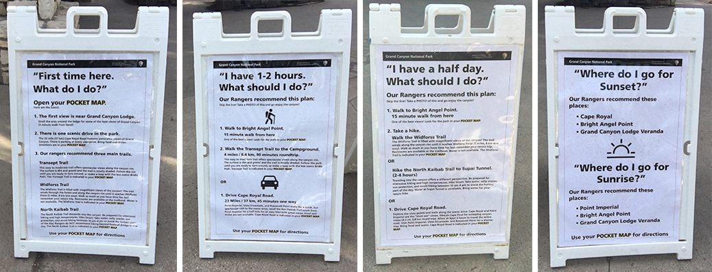
I especially liked the boards' advice to “take a photo of this and go enjoy the canyon”.
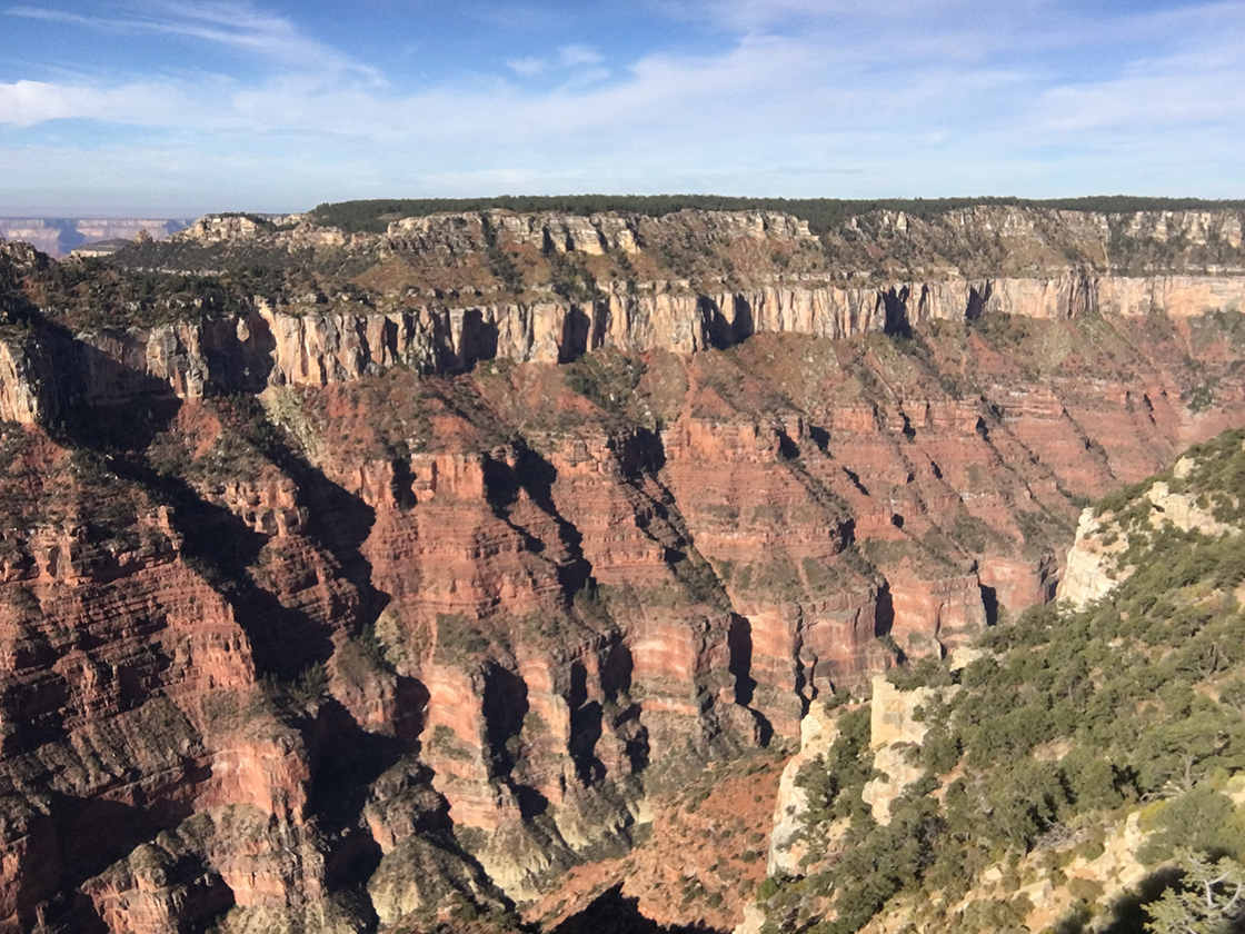
I walked to Bright Angel Point to get a view of the Grand Canyon. It’s amazing to think about how long the weathering took to erode the canyon down … and then to realize that it’s not like the ground started built up, but that those sedimentary layers had to all form over millions and millions of years. It’s … humbling.
Little did I know it, but I still had a massive day ahead of me.
I had a decision to make. I had wanted to see Zion and Bryce canyons. (Check!) I had hoped to see the Grand Canyon as well. (Check!) Cedar Breaks had been a “well, maybe?” … and I’d now seen that one, too. (Check!)
So now what? I could have maybe spent more time in the Grand Canyon, hiking down from the rim. Or I could head to the Southern Rim to check that out? Or, to be honest, I was missing the family, so I considered heading back home early. But, again and again, we’ve seen the value of optimizing for story. So that steered the ship. I decided to head down to check out Sedona, and then head west to LA and up the coast.
A friend of mine, Jamie, loves Sedona, so I figured I’d see what the deal was. I … didn’t see what the deal was. To be fair, COVID time is weird, and so I wasn’t able to go to cool shops, or cool bars, or whatever else it is that she loves so much about it. So I’ll have to head back some time we’re on the other side of this and check it out again.
So I get through Sedona, and then, several hours later, I skirt Phoenix, and pass through San Bernadino, Pasadena, Los Angeles, Santa Barbara, and on to a rest area on Route 101 between Gaviota and Las Cruces. I found a good spot in the parking lot, pulled the comforter around me, and slept in the driver’s seat for about six hours.
Day Four: Up Route 1
When I’d hit LA the night before, I had a few choices on route. Up the boring-but-straight-shot Route 5? Up the more-interesting-but-still-a-highway Route 101? Or the hug-the-coastline-and-pass-through-cute-small-towns-and-farms Route 1? Friends! We optimize for story around here! Up the 1 it was!
Sadly, I didn’t get any photos of my trip up the 1. But it was a great trip, with a number of moments packed into the day:
- Watching the fog roll in over the hills outside of Lompoc.
- Smelling something like jasmine mingling with the normal marine layer scents of eucalyptus, bay laurel, and coyote brush in the morning fog.
- Getting an undrinkable push-button latte at a local donut store, and then redeeming it with an actual latte from Quintessa Coffee, outside Pismo Beach.
- Passing a few previously-adventured locations, like Julia Pfeiffer Burns State Park (the trip that reinforced the value of Side Quests), or the old Coast Road that winds around from Big Sur up to the back side of the Bixby Canyon Bridge (I stayed on the 1 this time).
- Getting a blackened snapper sandwich from the Seabright Deli in Santa Cruz for lunch.
- Looking (unsuccessfully) for whales off the coast north of Santa Cruz.
- Enjoying the contrast of a bright blue sky when the rest of SF was gray and overcast.
Driving up the 1 was a lovely way to end the trip.
What’s Next?
This was a great trip, and I’m glad I was able to finally make it happen.
My next solo adventure, I think, will be a circumambulation around Mt. Tam. I think about three days of hiking will let me more leisurely approach the trip, rather than blitzing through the locations like I did with this one. I have a bit of planning to do for it, but I think it could be an amazing few days.
And I’ll hopefully have a better camera next time.